

The region of Chiemgau in Bavaria is in the foothills of the Alps, and its hilly landscape was formed during the ice age. Last year we travelled there for hiking and walked in the mountains on both sides of the German and Austrian border, heading up to Kampfenwand, Wilde Kaiser, Wandberg and the Blumen Weg next to Wildseelodersee. This year we returned and visited Lochner Horn, Brennkopf, Klausenberg, Sonnwendwand, as well as the beautiful lake Chiemsee. We still didn’t manage to get to do two of the iconic hikes in the area, up to the Geigelstein and Spitzstein, but it’s always good to leave something for another day.

Day 1: Lochner Horn, Wandberg and Brennkopf
This hike starts from the carpark across from the Sportplatz in Walchsee. Our friend’s friend was fast and had long legs, so running along after him we made quick time up the first steep hill, and we arrived at Lochner Horn much quicker than the suggested time indicated by the sign. We collapsed onto the grass for a long-awaited rest.


After relaxing for a bit, we headed on at a more leisurely pace, enjoying the idyllic green pastures laid before us. We had lunch at one of the Alms (I had soup with a cheese dumpling and a blackcurrant drink – Johannisbeer Schorle) and then climbed to the peak of nearby Wandberg, which brought back memories from last year’s hike. Last year it was the final hill and felt very high, but this time it felt fairly easy after the initial race up the hill in the morning). Afterwards we walked down to the Burgeralm to buy some cheese and eat some cheesecake. Finally we tackled one more peak – the Brennkopf, which was a nice-looking grassy hill – before heading back down. We had beautiful views of the Geigelstein and top and of Chiemsee on the way up and down – it really is a scenic hike.


At one point on the long walk down, my husband took what seemed to be a nice seat on a hill, before discovering that it was an ant heap. By accident I happened to take a photo of him at exactly the moment he was leaping up in realization that ants were biting him.

That moment you realize you are sitting on an ant hill


It was great to be walking around in the valleys in the Alps, which are so green and filled with flowers at this time of year. After going back to shower and freshen up, we had dinner in a Bavarian restaurant near to where we were staying. There we learnt about the tradition of Stammtisch – it is a table reserved for locals at a restaurant, and people show up randomly but regularly to talk about local affairs. We listened with interest to the Bavarian that the locals were speaking, as it is very different to German. Only when they switched back to German (presumably to talk to a non-Bavarian) could we understand what they were saying. Apparently not even Germans can understand Bavarian, and it is considered another language with various dialects being spoken in the Alps of Germany, Austria, Switzerland and Italy. Even the greetings are different, with peopel there typically saying Serwus, Griaß Di or Grüß Gott instead of the German “Hallo” or “Guten Tag”.


Day 2: Hofalm, Hammerstein, Zellerhorn, Laubenstein, Klausenberg
We started this hike directly from Aschau, and enjoyed walking through the lovely town to Hohenaschau.


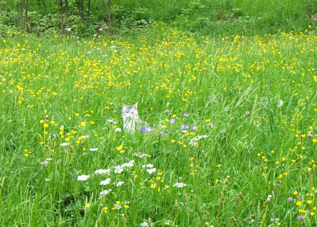
As we headed up the steep path to the Hofalm, we distracted ourselves from the steepness by gathering wild garlic (Bärlauch) to use later for dinner. We recognized it definitively as Bärlauch from the strong garlicky smell and the flowers, but be careful about just gathering leaves from similar looking plants as there are two plants with similar leaves to Bärlauch that are poisonous – the one (Lily of the Valley or Maiglöckchen) will give you hallucinations (not to mention other symptoms like nausea, vomiting and cardiac arrhythmias) and the other one (Herbstzeitlose) will kill you. Now, just imagine you have the plants growing next to each other, and you will see its wiser to take leaves from plants that have the right flowers and the garlicky smell so you can be sure what you’re eating.


At any rate, our discussions on the Bärlauch and foraging in general helped us pass the time on the long plod up the hill. Finally we arrived at the top of the path, which opened out into idyllic green meadows and the Hofalm. When the Hofalm is open, you can get fresh milk and cheese there, but it’s only open on weekends and public holidays. Nevertheless, they were kind enough to leave their toilet open, and we and some other hikers stopped for a picnic at the wooden tables and benches, enjoying the lovely views.

There is an easy path leading out of the meadow, but our friend had spotted an interesting unmarked trail following the wooded ridge on the left of the pastures on an earlier trip and was keen to try it. A full description of this hiking/climbing route can be read here but it seems like you may need some climbing skills and a rope to tackle it, which explains why we ended up skipping the last section of this hike, though it sounds as if we did most of it.


We followed the path up and along the ridge, climbing up the steep slopes, over grass, leaves, tree roots and mud. It was a nice walk and we got a spectacular view higher up. We reached the Hammerstein (Zellerberg) peak, marked by a cross, and then continued onwards.


At one stage the already steep and narrow path got a lot muddier and steeper, and we followed it up to a rocky crevice. There were some rocks to scramble over, with a metal wire to hold on to. As it was quite slippery, it was a bit of a tricky scramble over the rocks. Afterwards the path was easier, and we went through a wooded part before spotting another cross on another grassy/muddy slope, on what appeared to be a detour from the path. Apparently this is a memorial cross on the Zellerhorn. We made it up to the cross and were rewarded with a great view. On this rocky outlook, we felt as if we were as high up as the mountain goats, especially as the paths around looked more like goat trails than actual paths.


There was a path leading off to the right from this cross, and also one back down the slope, but following both led to only tricky looking paths, above a very exposed, steep slope. Deciding that going further would be foolish, we instead decided to make our way down through the forest, which involved walking slowly in zigzags down the steep slope through a forest. We ended up in a green valley, which we immediately dubbed the Secret Valley, since it was so quiet. We found a path leading out of this valley, albeit a very muddy one. We climbed out to find ourselves once again in green pastures (presumably on the Laubenstein), with an Alm nearby, and took a well-deserved rest on a log bench for cookies and water.


After our break, we headed off to the left again to continue the way to Klausenberg (1554m). It was again a steep uphill, this time on grassy slopes, now and then crossing some snow, until we made it to a rocky ridge covered with flowers. This walk along the ridge was my favourite part of the trail, as we were high up with views all around. Soon we reached the border between Germany and Austria, or Bavaria and Tirol as it is marked. The path took us into Tirol for a short while before we turned down into a valley and back into Bavaria, where the path then followed the Hammerbach stream back downhill.


It was a beautiful downhill walk through a grassy area, and then a dirt road back down to Hohenaschau. Unfortunately we did it an an army march pace since my fellow hikers wanted to reach the Edeka before it closed at 8pm in order to buy some ingredients to cook dinner. The dinner was well worth it in the end though, as we made a delicious risotto using our foraged Bärlauch and some seasonal green asparagus.


Day 3: Sonnwendwand
This hike is relatively short, but the difference in altitude is still 830m. The route takes you to the Sonnwenwand peak at 1512m. If you have more time, you could also visit the Kampfenwand, which signs say is only about an hour away. We did not do so on this occasion because one of our group was tired. The hike starts in Hainberg, where you follow an uphill path next to a river and through forest up to some meadows.


Lily of the valley / Maigloeckchen (NOT wild garlic!)
The path continues uphill quite steeply before evening out into a grassy meadow again. The last section of the path becomes more rocky, before you reach the Sonnwenwand peak and can stop to enjoy the view.


The way down follows the same path, and we stopped for something to drink at the Hofbaueralm. On asking about a toilet, the owner told us that there was one, although it was basic. Basic was no understatement, as it was literally just a wooden structure containing a toilet seat over a hole which led directly down to the ground (i.e. someone walking past would see everything going through). Therefore, if you use it, better make sure you don’t have an audience 😉

The way back down the river was pleasant, as this time we could enjoy the walk instead of struggling up the hill.


After our hike (which felt very short to me after the long one of the day before), we stopped for “Kneippen”, which is the tradition of walking around in very cold mountain spring water to get the circulation going and refresh the feet. the long awaited storm of the past days finally started, and as we were walking around in the cold water we heard the distant rolls of thunder, so we hurried up.

We managed to get safely back home before the storm started, and from the apartment window we watched as sheets of rain swept over the Sonnenwand where we had been sitting earlier. It’s probably just as well we didn’t opt for the longer hike that day. However, as the next day we would also not hike but visit Chiemsee, I felt a little bit sad that our hiking in the Alps was over. The good thing about mountains is that they don’t go anywhere though – so I’ll be back.


Woah..
Beautiful place with amazing photos
Thank you so much for sharing
I often think that after such wonderful trips how does one even feel like coming back home?
I did feel a bit blue the day after, because it’s always difficult to leave such a beautiful place and come back to the city! Especially because I always miss the mountains, having grown up around mountains and now living somewhere flat.